Flood emergency: Corps of Engineers in Vicksburg activates Operations Center
Published 2:56 pm Tuesday, January 8, 2019
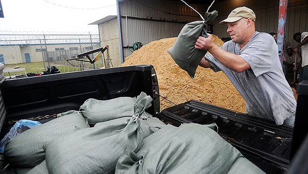
- (File photo) Crews make preparations for a previous flood along the Mississippi River.
VICKSBUR — The U.S. Army Corps of Engineers Vicksburg District activated its Emergency Operations Center to “emergency watch” status Jan. 3 due to forecasted high water on the Mississippi River and its tributaries.
During an emergency watch, Corps of Engineers personnel monitor the conditions of all federal flood control works, including levees, flood walls and pumping stations. They also monitor rainfall amounts in affected areas and use National Weather Service data to determine if weather conditions warrant further action.
“We are currently experiencing higher than normal water stages in the region. We’ve activated our emergency operations center to monitor and prepare to fight the forecasted flood,” Vicksburg District Commander Col. Michael C. Derosier said. “The district has begun and will continue to work with its local, state and federal partners.”
The National Weather Service has forecast the Mississippi River to reach flood stage at the Arkansas City, Arkansas, and Greenville, Vicksburg and Natchez, Mississippi, gages by mid-January.
Citizens are encouraged to contact their local authorities and management officials for updates about conditions in their area, Derosier said. Additionally, citizens should avoid activities on or near flood control works.
As of Tuesday, USACE has 11 personnel engaged in emergency watch efforts, including increased monitoring of river forecasts, offering support to local levee sponsors and state officials and supplying flood-fight material to local sponsors as needed.
The district will continue monitoring the forecast and the condition of its flood control works to determine if further activation of its emergency response efforts will be required. As of Jan. 8, the district has observed no significant sand boils or seepage at flood control sites.
The Vicksburg District encompasses a 68,000-square-mile area across portions of Mississippi, Arkansas and Louisiana that holds seven major river basins and incorporates approximately 460 miles of mainline levees. The district is engaged in hundreds of projects and employs approximately 1,100 personnel.