Severe weather, including tornadoes likely for state on Easter Sunday
Published 8:39 am Friday, April 10, 2020
Easter day might be a stormy one for many residents in central Mississippi, as a line of severe weather preceding a strong cold front enters the state Sunday.
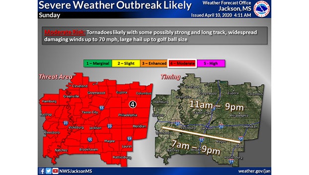
The National Weather Service in Jackson said there is a moderate risk for severe weather in a large portion of the state from Oxford in the north to McComb and Hattiesburg in the south. The storm system is scheduled to move across the state from 7 a.m. in the west to 9 p.m. in the eastern part of the state.
Van Byrd, a meteorologist with the National Weather Service Office in Jackson said the frontal system is forecast to move through the state Sunday morning and last into the early evening with rain, the possibility of tornadoes and golf-ball-size hail.
Byrd said outbreaks of tornadoes are expected in the state with some possibly being long-track tornadoes that could travel on the ground for a long distance. Besides the hail, damaging winds with speeds up to 70 mph are also expected.
Cooler weather will follow the system, with highs in the 60s and lows possibly falling into the 40s Wednesday and Thursday with temperatures warming up after Thursday.