Easter storm could bring tennis ball hail and long, powerful tornadoes
Published 10:23 pm Saturday, April 11, 2020
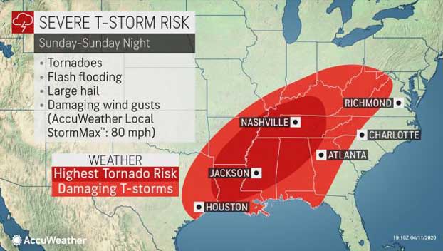
Weather forecasters say a severe weather system moving into Mississippi Easter Sunday may bring strong winds, heavy rains, strong tornadoes and tennis ball sized hail to areas of the state.
Meteorologist John Moore with the Jackson office of the National Weather Service urged residents to be prepared and stay weather aware.
“We’re going to be under the gun for a long time tomorrow,” Moore said.
“We’re expecting a severe weather outbreak,” he said. “We can expect all modes of severe weather including the possibility of strong, long-track tornadoes.”
Moore said it’s a 4 out of 5 risk on the National Weather Service’s scale. High winds could be problems with forecasters predicting some areas might see damaging winds of up to 70 mph, just below that of a hurricane.
“We’re expected storms in the western portion as early as 5 a.m.,” he said. “It’s going to be multiple rounds throughout the day. They’ll get near the I-55 corridor around noon.”
Moore said the most likely time for the worst weather is expected to be in afternoon and early evening hours.
A long-track tornadoes are tornadoes that are on the ground for 25 miles are more.
Please pay attention today to the weather forecast in your area.


