Satellite imagery shows long paths where tornadoes scoured Mississippi earlier this year.
Published 11:24 am Monday, May 18, 2020
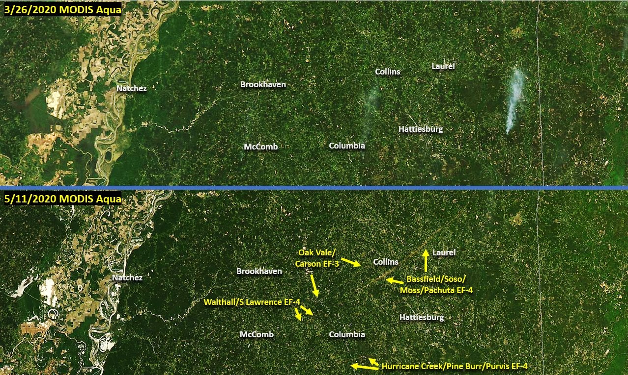
It’s easy to see the impact tornadoes have on the lives of people in their paths, particularly if you are one of those people or know someone affected. But it’s often a little more difficult to see the scope of the actual damage to the environment.
The National Weather Service’s Jackson Office shared before and after satellite images of a section of south central Mississippi and the storms — one of which was the widest tornado to ever touch down in Mississippi – and the results are pretty amazing.
One of the EF4 storms cut a swatch dozens of miles long, altering the landscape, likely for many years to come.
The images came from the MODIS Aqua satellite imaging. MODIS is an acronym for Moderate Resolution Imaging Spectroradiometer (say that five times fast).