Brrrrrr! Storm system ushers in cooler weather
Published 5:17 pm Wednesday, December 14, 2022
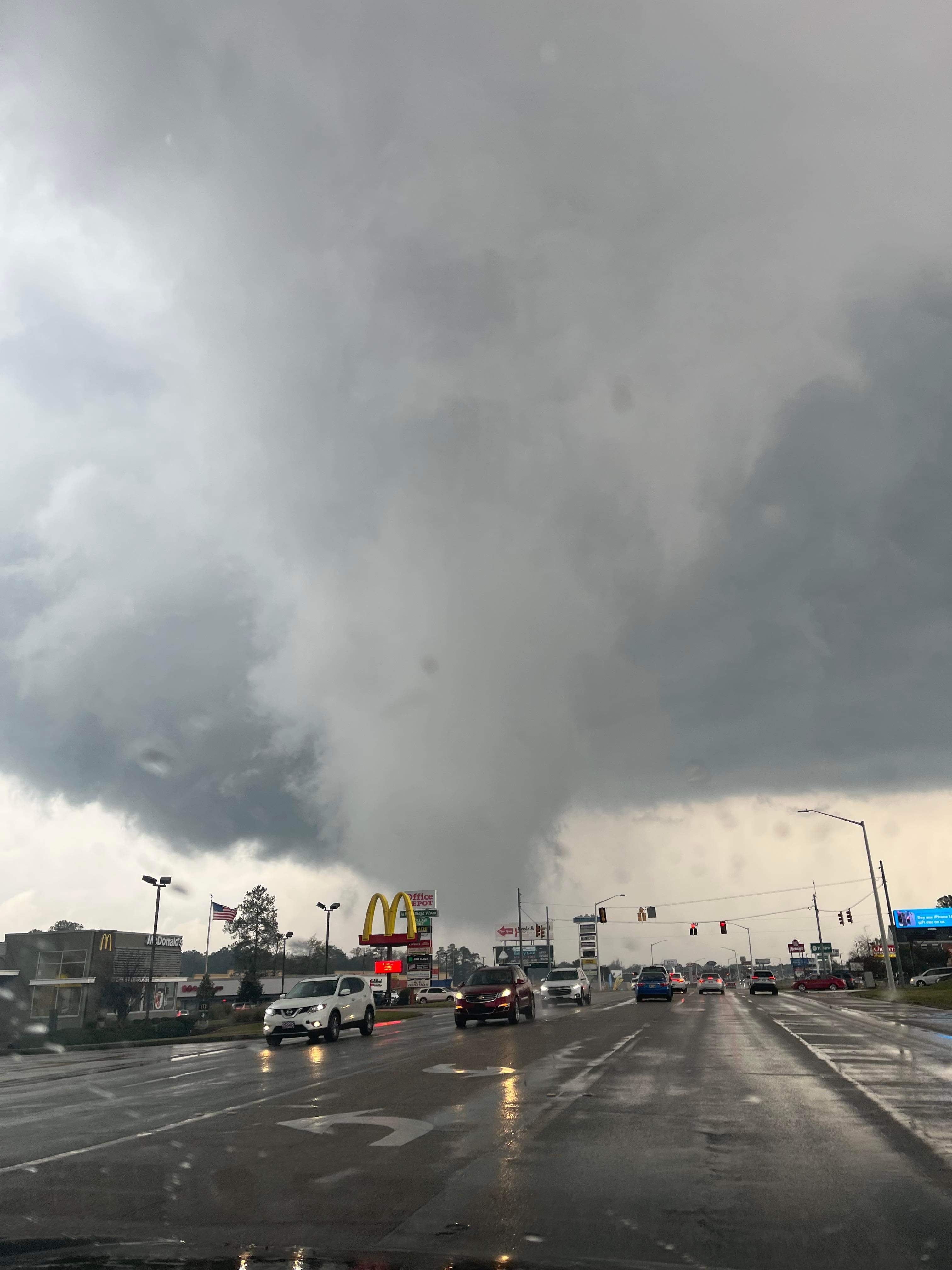
- A funnel drops from a tornado-warned storm along 16th Avenue in Laurel's commercial district in December. The same storm, photographed by Teresa McCreery, would later develop a confirmed tornado in parts of Jasper, Clarke, and Lauderdale counties.
After a solid 24 hours of tornadoes, severe storms, hail, and flash flooding, we’ll get a well-earned break with beautiful days and crisp nights. Any lingering clouds will clear the state Thursday, leaving behind much more seasonable weather.
Temps will range from highs in the 40s near Batesville and Oxford to the 50s for Vicksburg, Natchez, and Brookhaven while Picayune will get into the 60s. Lows will dip into the 30s across the state. Other than a few lingering clouds leaving southern parts of Mississippi Thursday morning, the entire state will see brilliant sunshine the next few days.
Multiple communities across the state are still experiencing flooding Wednesday evening. U. S. 49 was closed in Hattiesburg due to feet of water across the major highway. The Mississippi Emergency Management Agency and National Weather Service offices will begin releasing specific storm reports within the next couple of days.
MEMA is reporting that about 7,000 customers are without power in Mississippi tonight. The largest concentration of power outages is just more than 2,100 customers in Warren County.
Some national weather forecasters are still hinting at some possible mischief concerning winter weather next week, just in time for Christmas. We’ll have a much better idea what the long-range forecast shows Thursday evening.


