Mississippi Skies: New work week brings new severe threat
Published 6:20 am Monday, January 2, 2023
Spring weather lovers have had an incredible couple of days. Unfortunately for them, there’s another type of spring-like weather on the way.
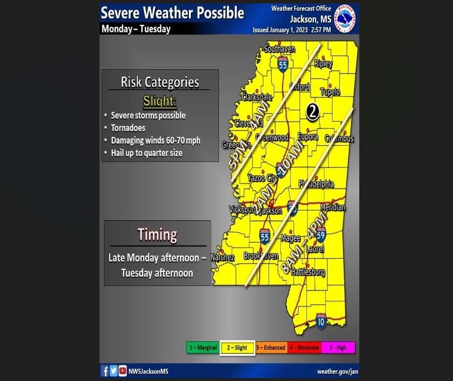
The entire state will be under the threat of severe thunderstorms, hail, damaging winds, and even tornadoes beginning this afternoon and lasting through Tuesday afternoon. The good news is this threat comes in at lower levels, so it’s not expected to be as widespread or as strong as rounds of storms recently. The worst weather from this front is expected to be just west of us.
North Mississippi
Cloudy with a slight chance of rain in the morning with storms likely in the afternoon. Up to a tenth of an inch of rain is expected except higher amounts in thunderstorms. High of 60. Showers continue tonight with a low around 63.
Central Mississippi
Heavy rain and wind gusts up to 20 miles per hour possible with a high of 75 today. Tonight, storms move in with a low around 65.
South Mississippi
Mostly cloudy with heavy rain possible throughout the day. Highs near 76. Storms possible tonight with a low 68.
Gulf Coast
Patchy dense fog and cloudy with a slight chance of rain. Highs near 76. Showers continue overnight with a low near 65.