Mississippi Skies Bulletin: Parts of Mississippi upgraded to Level 3 severe weather risk
Published 7:22 pm Monday, January 23, 2023
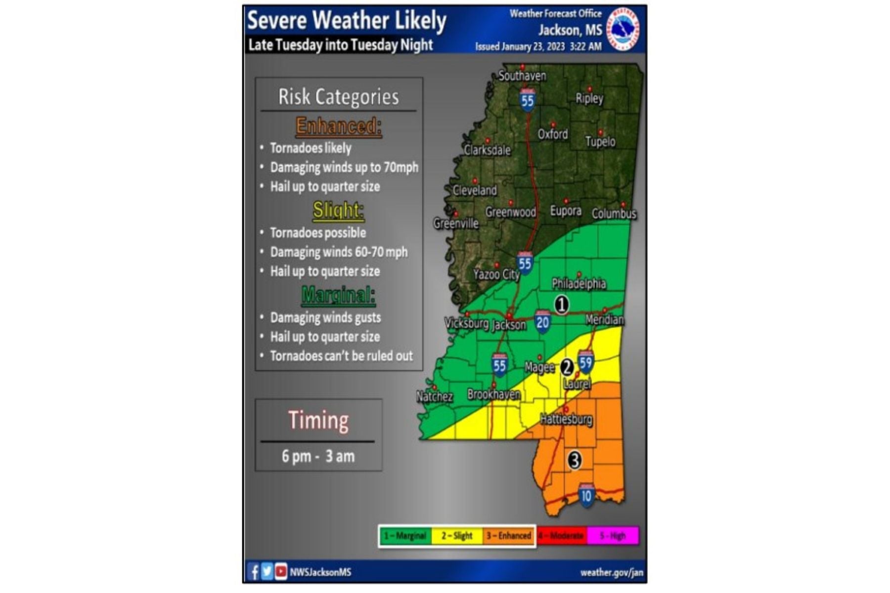
The Storm Prediction Center has upgraded the risk for tornadoes and severe storms in parts of Mississippi Tuesday night. Even in areas that aren’t under the risk for severe weather, strong winds could gust up to 40 miles per hour.
The highest risk, a Level 3 out of 5, includes Hattiesburg, Picayune, Poplarville, Wiggins, Lucedale, and the Gulf Coast. According to the National Weather Service, tornadoes are likely, damaging winds up to 70 miles per hour are likely, and hail up to a quarter in size is possible.
The Level 2 risk is a diagonal stretch that includes Quitman, Laurel, Collins, Columbia, and Woodville. In this area, tornadoes are possible, along with 60 to 70 mile per hour winds, and hail up to quarter size.
The Level 1 risk is also a diagonal stretch but includes a much larger area. This threat includes just south of Columbus and Starkville, Philadelphia, Jackson, Vicksburg, Brookhaven, McComb, and Natchez. People in this area should know an isolated tornado is possible, along with damaging wind gusts and hail up to a quarter in size.
Right now, storms are expected anytime between 6 p.m. Tuesday through 3 a.m. Wednesday. We’ll have the latest timing and threat levels Tuesday morning.