Mississippi Skies: Severe weather threat expands across the state; temperatures about to drop
Published 9:03 pm Sunday, March 31, 2024
Monday will begin our week with plenty of clouds, heat, and humidity, but some big changes are coming.
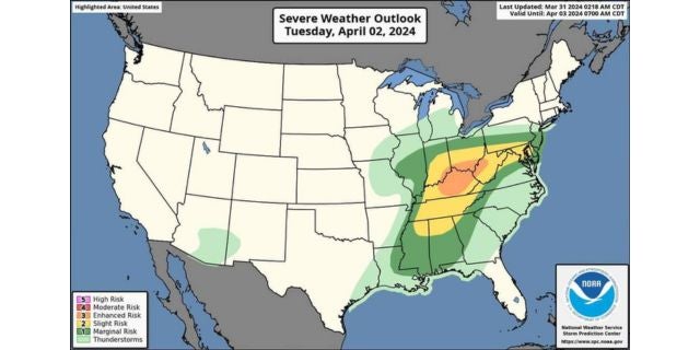
The entire state is now under a Level 1 risk from the Storm Prediction Center except for a Level 2 risk clipping the northeastern corner. Risks will be heavy rain, severe storms, hail, and strong winds. Although the tornado threat is very low for us, it’s not zero. The main tornado threat will impact our neighbors to the north in Tennessee and farther towards Kentucky and Ohio. If you’re traveling in that direction, please use caution as the tornado impact could be significant in that area.
Our main risk for any strong to severe storms will be during the day Tuesday into early Tuesday evening. Once we get the storms to move out, we’ll notice a drop in temperatures. Wednesday will be dry with cooler temps and lower humidity. We could have some lows near freezing by Thursday night.
North Mississippi
Mostly cloudy with a high of 81. Overnight, there is a chance of a shower or thunderstorm, especially towards Tuesday morning. Low of 67.
Central Mississippi
Cloudy and windy with a high of 83. Mostly cloudy overnight with a low of 67. Wind gusts up to 25 miles per hour.
South Mississippi
Fog in the morning. Mostly cloudy and breezy with a high of 83. Monday night, mostly cloudy with a low of 67. Wind gusts up to 20 miles per hour in the day and 25 miles per hour at night.
Gulf Coast
Mostly cloudy with a high of 81. Mostly cloudy at night with a low of 67.


