Mississippi Skies: Approaching front bringing potential for strong to severe weather
Published 8:52 pm Wednesday, March 6, 2024
We’ll see clouds enter the state Thursday with northern and central Mississippi becoming cloudy during the day and southern Mississippi becoming cloudy in the evening.
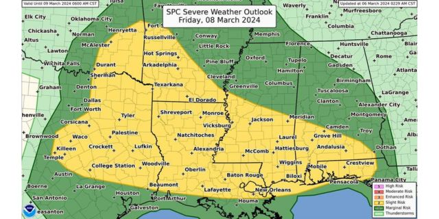
Storms arrive Friday with a Level 2 risk for severe weather covering a zone from Greenville to Philadelphia to Meridian and south. In this zone, severe storms with damaging winds, hail, and tornadoes are possible on Friday and Friday night.
A Level 1 risk covers most of the rest of the state with the same risk with less of a tornado threat.
In addition to the severe risk, we also have a threat for flooding across the state as heavy rain moves through the state.
North Mississippi
Cloudy with a high of 70. Thursday night, a slight chance of a shower with a low of 57.
Central Mississippi
Mostly cloudy with a high of 75. Cloudy overnight with a low of 59.
South Mississippi
Fog early. Partly sunny with a high of 78. Mostly cloudy Thursday night with a low of 58.
Gulf Coast
Sunny with a high of 77. Becoming mostly cloudy overnight with a low of 60.