Mississippi Skies Bulletin: Severe weather with tornado threat this evening and overnight
Published 7:01 pm Monday, March 25, 2024
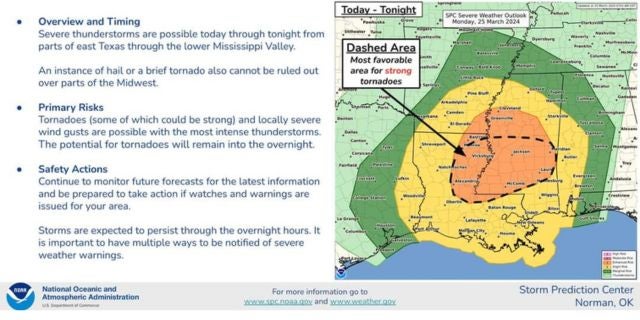
The Storm Prediction Center has expanded the “most favorable area” for tornadoes in Mississippi.
The latest information includes a large portion of the state with a highlighted tornado threat. Cities included are Natchez, Vicksburg, Jackson, Clinton, Brandon, Port Gibson, Brookhaven, McComb, Prentiss, Collins, Laurel, Meridian, Magee, Mendenhall, Hazlehurst, Raleigh, and smaller communities in the area. Columbia and Hattiesburg are right on the border.
A tornado watch has been issued for much of the state.
From the National Weather Service:
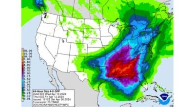
“Severe thunderstorms are likely to affect our forecast area Monday afternoon into Monday night. The primary hazards will be damaging wind gusts and tornadoes, and some strong or long-tracked tornadoes will be possible. Hail up to the size of quarters will also be possible. Now is the time to review your plans and know where you will go if severe weather approaches your area.”
Storms should end by 9 p.m. in the Delta, midnight in western Mississippi, 2 a.m. in central Mississippi, and 4 a.m. in eastern Mississippi.
Have your safety plan ready for severe storms or tornadoes to develop. People living in a mobile home or RV should consider staying in a hotel, with a friend or family, or other substantial structure. Some communities are opening severe weather shelters.
For current weather information, visit www.weather.gov