Mississippi Skies Bulletin: Severe threat level upgraded for most of the state
Published 5:56 pm Tuesday, February 7, 2023

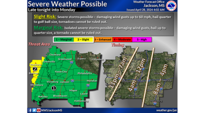
We’ve been discussing the potential for a few isolated severe storms on Wednesday since last weekend. Today, the National Weather Service upgraded the chances more of us will see those storms.
The Storm Prediction Center has issued a Level 2 risk for most of the state from the Tennessee line down to Picayune. The threat also includes from the Mississippi River to the I-59 and U. S. 45 corridors in the eastern part of the state. East of that line is under a Level 1 risk with the chance for some severe storms, strong winds, hail, and isolated tornadoes.
The main threat begins mid-afternoon as a cold front marches through Mississippi. Severe storms are possible with winds from 60 to 70 miles per hour, medium-sized hail, and tornadoes. Storms will continue into the wee hours of Thursday morning.
We will have more details with the next forecast.