Mississippi Skies: Window opening for better chance of severe storms, flash flooding
Published 11:59 pm Friday, January 27, 2023
If you have outdoor plans this weekend, today is the day to make those happen. Although northern parts of the state will begin to see clouds moving in, most of the rain holds off until tonight.
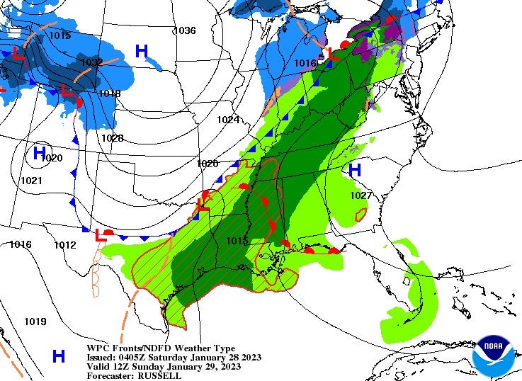
Although we’ve been expecting a chilly rain for tonight and Sunday for several days, some models are beginning to hint at the possibility of a short time frame where there will be enough instability and warm air to help a couple of severe storms develop on Sunday, especially in southern Mississippi from the Mississippi River to the Pine Belt. Regardless of any severe storms, there will still be areas from central Mississippi to the Gulf Coast that have the potential for flash flooding and up to three inches of rain.
North Mississippi
Increasing clouds and breezy with a high near 58. Rain moves in tonight with an 80 percent chance and a low of 51.
Central Mississippi
Frost early, then partly cloudy with a high of 61. Wind gusts up to 20 miles per hour are possible. Tonight, mostly cloudy with a 50 percent chance of rain overnight. Wind gusts up to 30 miles per hour are possible with a low of 48.
South Mississippi
Widespread frost and then partly cloudy with a high near 64. Wind gusts up to 20 miles per hour. Tonight, increasing clouds with a slight chance of rain and a low of 50 with wind gusts up to 30 miles per hour.
Gulf Coast
Mostly sunny and warm with a high of 65. Becoming cloudy tonight with lows in the lower 50s.